EAST POULTNEY CEMETERY
 Located .2 miles east of the East Poultney green on a side road parallel to Rt. 140 East, the road to Middletown Springs. This cemetery contains many beautifully carved old stones with interesting verses.
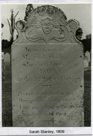
Enos Clark of Middletown Springs carved many of the stones dated before his death in 1815. All the stones with seraphs or angels are his work except for the Martha How stone. Many other early stones were the work of William Denison and Luther Perkins of Rutland and H. Hawley of Dorset.
POULTNEY TOWN CEMETERY
One of the largest in Poultney, it is located on the east side of Rt. 30, Beaman St, one and one half blocks north of the intersection with Main Street and Rt. 140.
ST JOHN’S EPISCOPAL CEMETERY, East Poultney
St John’s Church is on East Main Street across from the East Poultney green. It was founded between 1820 and 1825 and the building erected around 1831. The small cemetery is behind the church.
JEWISH CEMETERY, East Poultney
This well kept cemetery is located across from the East Poultney Cemetery on the north side of the same access road. All the stones have Hebrew or Yiddish inscriptions, with English inscriptions added at the bottom or on the back.
ST RAPHAEL CATHOLIC CEMETERY
The entrance to this cemetery is beside the church on East Main Street one block east of Rt. 30.
AMES CEMETERY
This cemetery is located in the northeast corner of Poultney. The road from East Poultney to the cemetery is now only a foot or horse path. By car drive east from Castleton Corners (the intersection Rt. 30 and Rt. 4A) about 4.4 miles. Turn right on to a dirt road and drive south about 3 miles. The cemetery is on the left, about 100 feet in from the road.
TRAVERSE CEMETERY
This new cemetery is located beside the Ames Cemetery and enclosed in a chain link fence.
FIFIELD CEMETERY
This cemetery is located on the east side of Rt. 30 four miles north of the stop light in Poultney. It is in a clump of trees, about 50 feet east of and barely visible from Route 30. There is no parking area along the road.
HOSFORD TOMB
This tomb is located west of Rt. 30 at the edge of a field 3.3 miles north of the stop light in Poultney. It was built into the side of the hill. In 1900 and again in 1970 the tomb was repaired and sealed by the owners of the property. Besides the family it is said to contain the remains of a black man who died on the railroad near the spot. A stone which sits atop the entrance to the tomb is inscribed “Erected by Philo Hosford 1844.”
HOSFORD’S CROSSING CEMETERY
The Hosford’s Crossing Cemetery is located west of Rt. 30, 3 miles north of the stop light in Poultney. It is just beyond where the railroad once crossed the highway.
BROUGHTON CEMETERY
To locate the cemetery, from blinker light in the village, drive south on Rt. 31 1.6 miles, turn left on the Highland Upper Rd and drive south .4 miles. There is a small private drive to the south of the cemetery. The cemetery is about 200 feet west of the road. The cemetery is in part of Poultney, which was originally part of Wells.
WARD CEMETERY
This small cemetery is on Finel Hollow Rd, 2.3 miles north of Rt. 140 and .7 miles east of the East Poultney green. It is located on the old Nehemiah Howe homestead. Nehemiah died in 1777 and it is supposed that he and his wife Betsey (Wheeler) Howe are buried here but no stones mark the spot. Their son John later sold the property to Delbert Pease. There are numerous slate slabs, which probably mark graves.
The William Ward homestead is just southwest of the Cemetery and The Town Farm was in Hampshire Hollow, not far from this spot.
RANSOM CEMETERY
To locate this cemetery, drive north from the green in East Poultney on Hillside Road .3 miles: turn left on Lewis road and drive 1.3 miles turn left on Hannon Road and drive .1 mile. This cemetery is located in a field, near a stonewall about 500 feet beyond the house.
CULVER CEMETERY
This is an abandoned cemetery in the northwest corner of Poultney. It is on the east side of the Poultney-Blissville-Hydeville Road, just south of the Castleton town line. From the stop light in Poultney, drive north on Rt. 30 3.1 miles: turn a sharp left, pass the Hosford cemetery and drive west .3 miles: turn right or north and drive 1.6 miles. The cemetery has a stonewall and is well above street level.
BUNCE CEMETERY
This cemetery is located on Hampshire Hollow Road .4 miles north of Rt. 140 and just beyond the former Bunce house.
Information and gravestone photos courtesy Margaret R. Jenks from “POULTNEY CEMETERY INSCRIPTIONS RUTLAND COUNTY, VERMONT: 1996”